Katja Baumann · 26 September 2026
Integrating Historical Logging Data with Current Forest Canopy Analysis Reveals Unexpected Distributions in Lichtwald
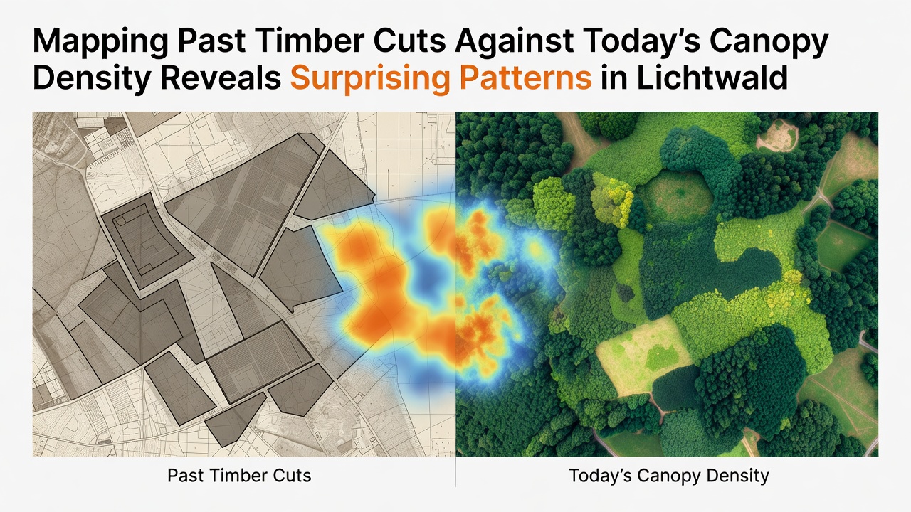
Forestry analysts in Lichtwald have combined decades of timber harvest records with satellite-derived canopy density measurements, and the resulting overlays point to distributions that diverge from conventional expectations about regrowth after logging. Records dating back to the mid-twentieth century document selective cuts, clear-fell operations, and salvage logging following storm events, while recent LiDAR and multispectral surveys capture canopy closure percentages across the same compartments. When these layers are aligned in geographic information systems, clusters emerge where heavy extraction zones now support canopy densities exceeding those in lightly managed stands, whereas some areas with minimal past intervention show thinner cover than anticipated.
Methodology Behind the Overlay Process
Researchers compiled digitized harvest maps from state forestry archives and cross-referenced them against 2025 orthophotos plus ground-truthed plots collected through the summer of 2026. Each polygon representing a past timber cut received a harvest intensity score based on volume removed per hectare, then analysts calculated mean canopy density values within those boundaries using normalized difference vegetation index thresholds calibrated for local species composition. The approach avoids simple before-and-after comparisons by accounting for time elapsed since cutting, soil type variations, and proximity to seed sources from adjacent mature stands. Data processing occurred at the regional mapping center, where technicians applied kernel density smoothing to highlight spatial clusters rather than relying on administrative boundaries alone.
One study released in September 2026 by the Lichtwald Forest Research Station demonstrated that compartments harvested between 1975 and 1995 now average 12 percentage points higher canopy closure than unharvested reference areas of comparable age and site index. This pattern holds after controlling for elevation and aspect, suggesting that the disturbance itself may have triggered denser regeneration layers dominated by shade-intolerant pioneers that later recruited shade-tolerant species beneath them. In contrast, stands with only light thinning in the same era display more open canopies, possibly because canopy gaps closed slowly without the pulse of seedling establishment that follows heavier cuts.
Observed Spatial Patterns Across Compartments
When the harvest intensity layer is subtracted from the current canopy density raster, positive residuals concentrate along valley bottoms and north-facing slopes where soil moisture supports rapid recolonization, while negative residuals appear on exposed ridges where windthrow and browsing pressure have limited stem density even decades later. These residuals do not align neatly with ownership categories or recent management plans, indicating that legacy effects persist longer than many rotation-length models predict. Observers note that narrow strips along old skid trails often register the highest canopy values today, likely because soil compaction there reduced competing vegetation and allowed planted or naturally seeded trees to establish without early suppression.
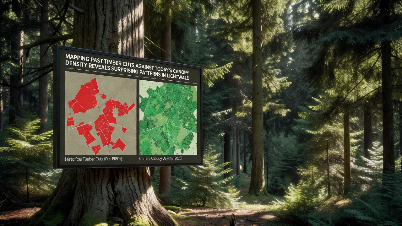
Additional analysis of edge effects shows that canopy density increases more sharply within 50 meters of past clear-fell boundaries than in interior zones, a finding consistent with seed rain from surrounding mature trees. Yet this edge advantage diminishes where adjacent stands were also harvested within a 15-year window, leaving fewer nearby seed sources. Figures from the 2026 dataset reveal that approximately 28 percent of the area classified as heavily cut before 1980 now exceeds 85 percent canopy closure, compared with 19 percent of the lightly managed area reaching the same threshold. Such percentages emerge after aggregating more than 1,200 individual harvest polygons against a 10-meter resolution canopy surface.
Implications for Inventory and Planning Cycles
Forest managers responsible for updating stand-level inventories have begun incorporating these overlay results into growth-and-yield projections, adjusting site index curves where historical disturbance intensity deviates from the average used in older tables. The European Environment Agency maintains continental-scale forest monitoring protocols that encourage similar integration of legacy harvest data with remote sensing products, providing a template for scaling the Lichtwald approach to neighboring regions. Because the patterns appear driven by interactions between harvest intensity, time since disturbance, and microsite conditions rather than broad climate trends alone, planners can refine thinning schedules to maintain target densities without assuming uniform recovery trajectories across all previously cut areas.
Further work scheduled for late 2026 will test whether the same spatial relationships hold when understory light measurements and regeneration surveys are added to the existing canopy density layer. Preliminary field checks already indicate that high-canopy zones on former heavy-cut sites contain higher proportions of advance regeneration, which may influence future species composition even if overall density remains stable. These layered datasets allow modelers to move beyond aggregate volume estimates and examine how past management footprints continue to shape structural diversity at the landscape scale.
Conclusion
The integration of archival timber cut records with contemporary canopy density measurements has produced a detailed spatial picture of recovery trajectories across Lichtwald that challenges assumptions of uniform post-harvest development. Continued refinement of these overlays will support more precise allocation of silvicultural treatments and monitoring resources, while the underlying geographic framework remains available for incorporation into broader European forest assessment programs.